Land & Water / Roy Kizer Golf Course / February 2026
Roy Kizer Golf Course: Pond Sealing Plan
Drone-mapped bentonite application areas, material quantities, and a staking grid to seal leaking ponds.
The problem
The ponds leaked. A municipal complex was losing water through beds that wouldn’t hold it, and the fix was bentonite: a clay that swells and seals once it’s worked into the bed. The catch is that bentonite only helps where you put it, at the rate the bed needs. Spread it by eye and you either miss the leak or blow the budget.
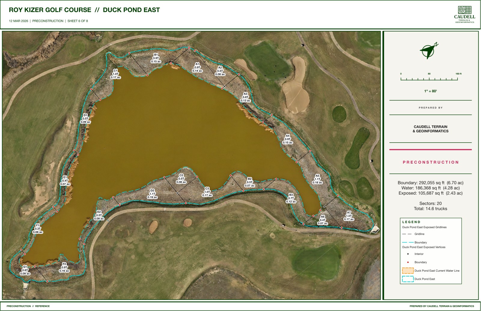
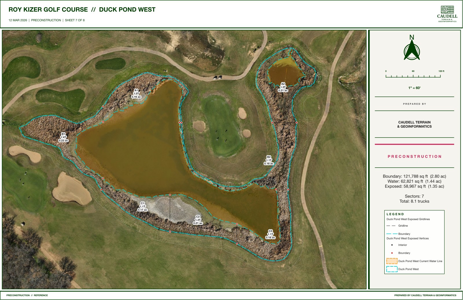
What we flew and mapped
With the ponds drawn down, we flew the exposed beds and mapped each one: the application boundary, how much of the bed was exposed, and a grid of numbered sectors laid over it. Boundary and interior stakes give the crew control points on the ground, so each sector can be found and treated in order. The duck ponds alone came to about 3.78 acres of application area, twenty-seven sectors, and twenty-three truckloads of bentonite.
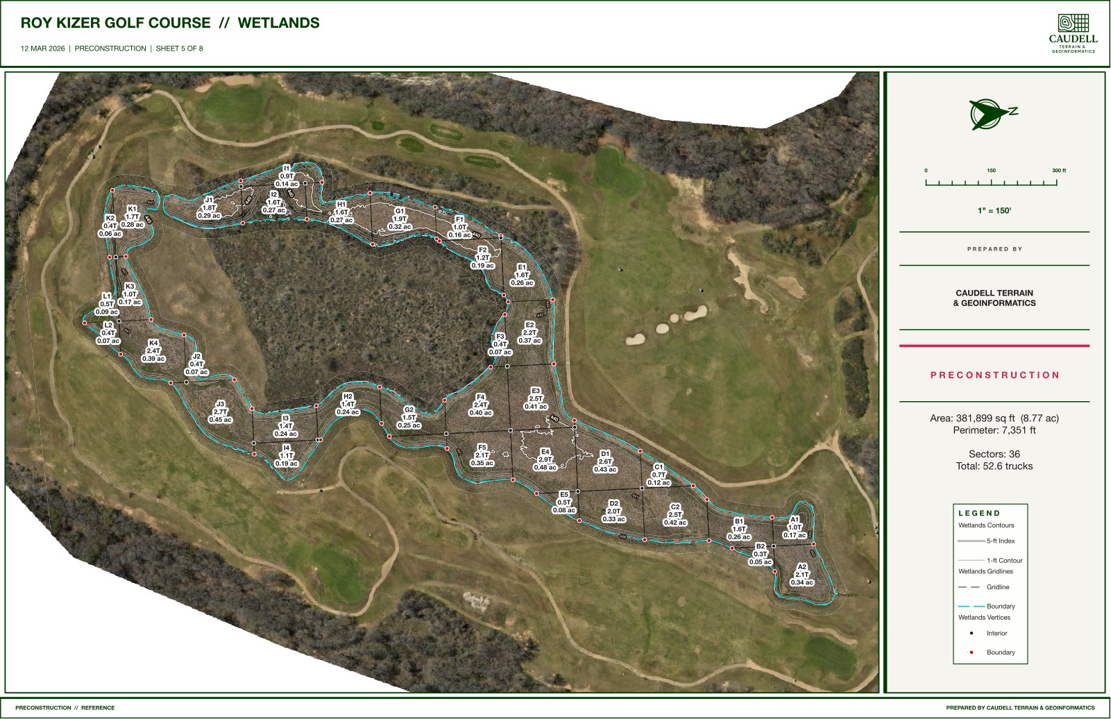
The wetlands
The wetlands ran the same way: a larger, shallower footprint, gridded into sectors so the crew could work it in pieces instead of guessing across one open expanse.
What it gave them
The crew always knew where the bed was exposed, which sector they were standing in, and how much bentonite it took. Material was ordered to a real number, in truckloads, not a round-number guess. And the same flights later carried the bunker takeoff, so a single capture served two projects.
Get in touch: jacob@caudelltg.com