Land & Water / Grimes County Ranch / June 2026
Grimes County Ranch
Terrain and constraint analysis to help decide where to build on a flood-shaped tract.
The tract
A multi-tract ranch in Grimes County, Texas. The owner needed to know where the dry, stable ground actually was before he committed to a building site. From eye level the upland and the bottomland blur together. The contours and the water don’t.
What we flew and modeled
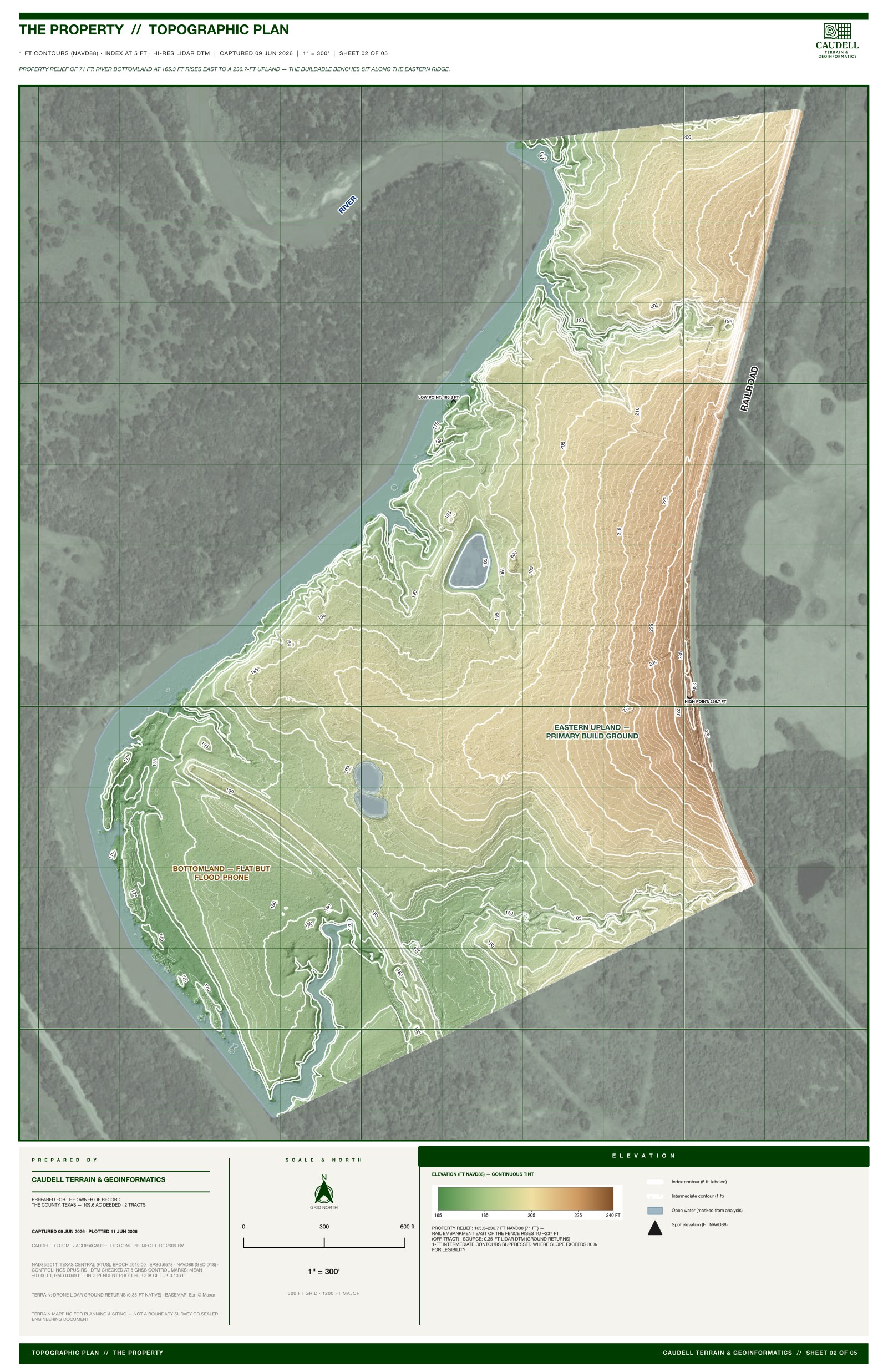
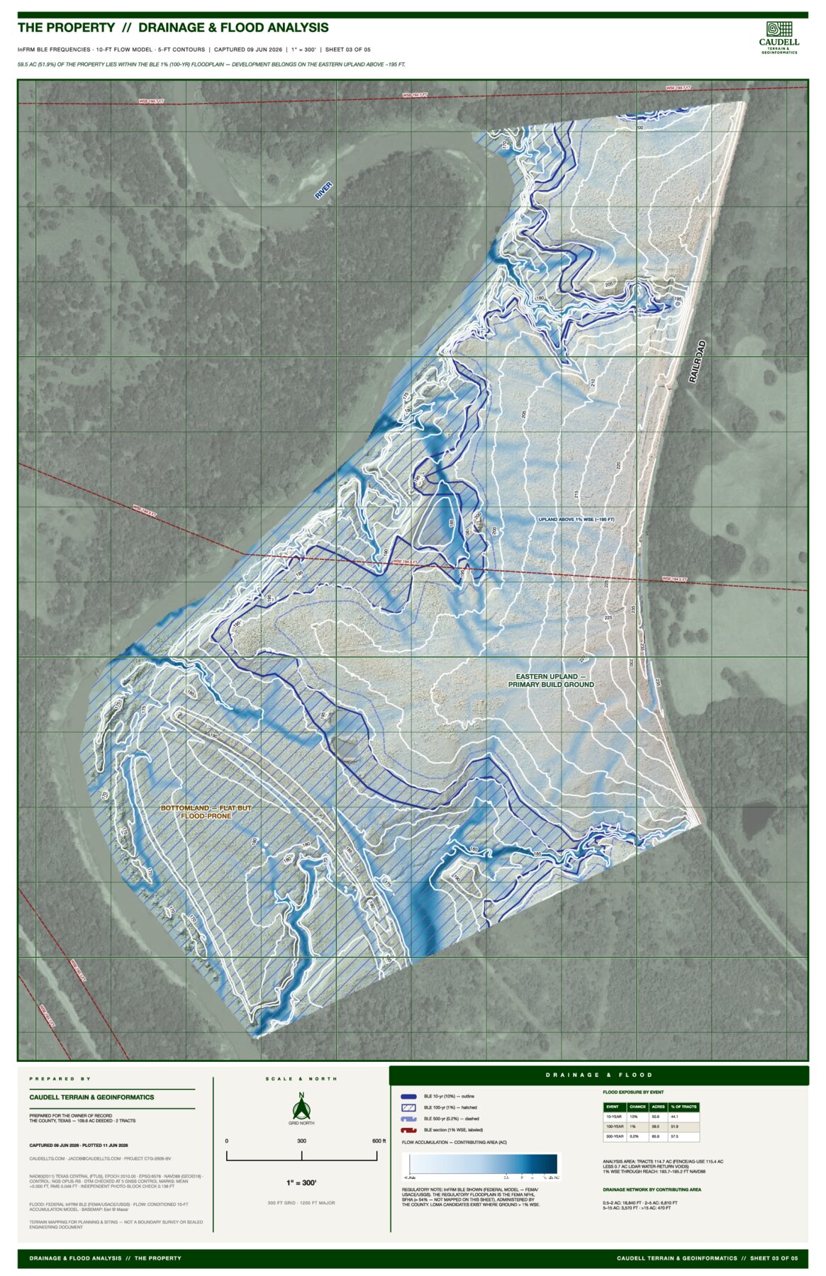
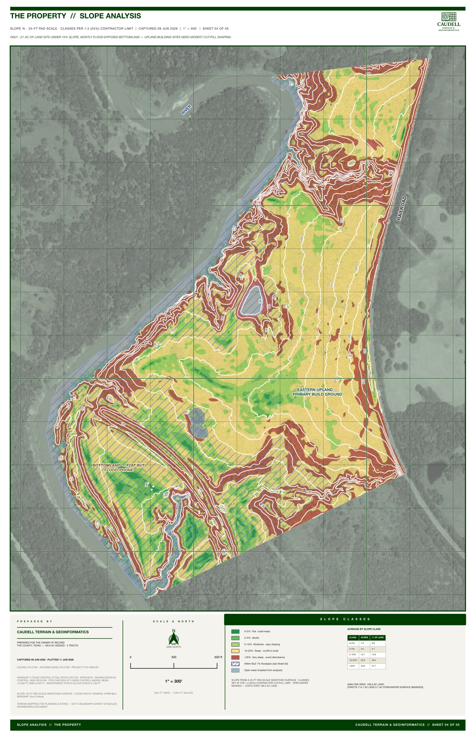
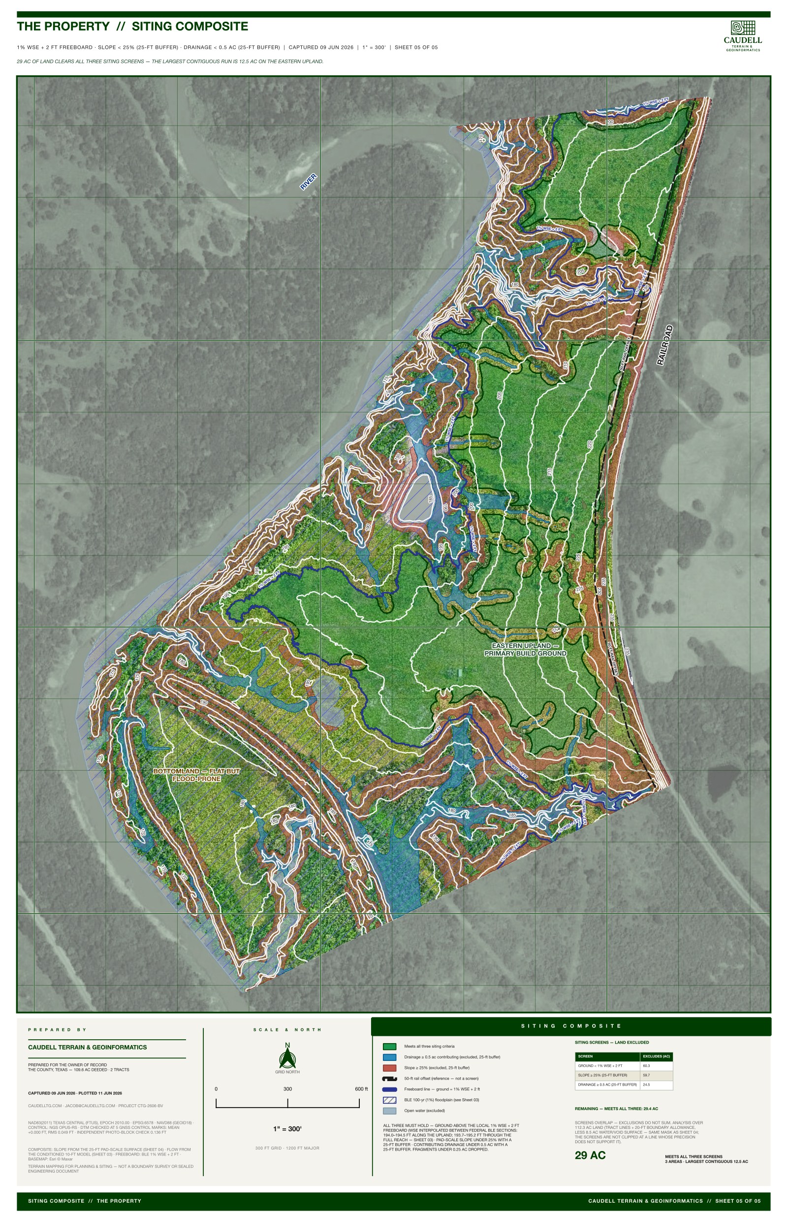
We flew the property with drone LiDAR and built the terrain out to one-foot contours, indexed every five. From that surface we derived slope, flow accumulation, and a flow-frequency model of how water gathers and moves across the tract through the ten- to hundred-year events.
Reading the ground
The model splits the property cleanly. The eastern upland is the high, stable ground, and it stays clear of the modeled flood extent. The bottomland is flat and inviting, and it floods. We drew the line between the two and put acreage to each, so the tradeoff is a number instead of an argument.
The exhibits
The deliverable is a set of plan-scale exhibits: a drainage and flood sheet with the modeled flood extent and flow network, a slope and contour base, and a build-ground summary table. All of it made to be read across a table by the people making the call.
What it informed
The owner walked away with the buildable footprint identified and quantified, and a clear picture of what to keep clear of. The exhibits informed the siting decision. They didn’t make a regulatory one, and they were never meant to.
Get in touch: jacob@caudelltg.com