Selected Work
A working record across Texas golf and land.
Golf
01
Odessa Country Club · March 2026
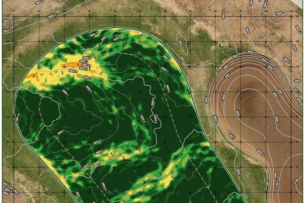
Odessa Country Club: Greens Performance Analysis
We flew every green at Odessa Country Club and modeled each putting surface in high fidelity: slope and contour, which pin positions still hold and which have crept too steep to cup, and the lines water takes off the green.
Read →
02
Roy Kizer Golf Course · June 2026
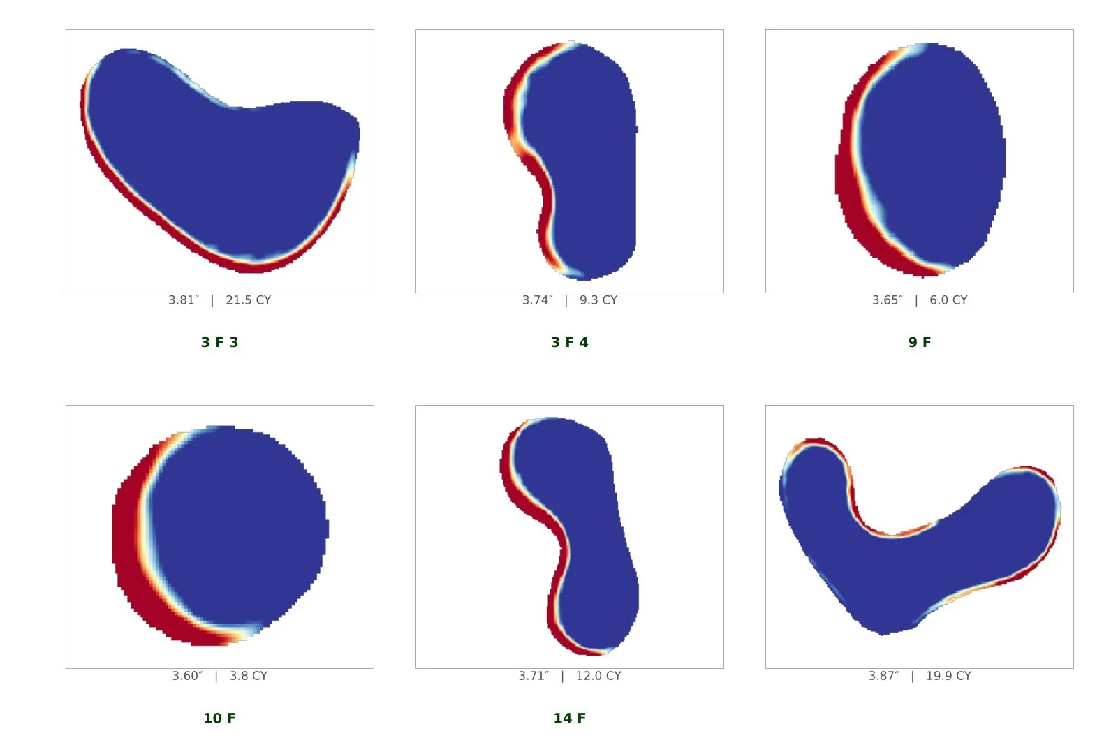
Roy Kizer Golf Course: Bunker Rehabilitation Modeling
A municipal course wanted to rebuild its bunkers and needed a real number to take to the city before anyone would sign off. We already had the terrain from the lake project, so we put it to use: depth, sand volume, and a material-cost range for all forty-one bunkers.
Read →
03
Odessa Country Club · April 2026
Odessa Country Club: Irrigation As-Built
The Links Course irrigation plan had drifted from the ground after years of repairs. We located every active head from the air, tied each one to a high-fidelity 3D model of the course, and checked them in the field: a head layout that matches what's out there.
Read →
04
Odessa Country Club · May 2026
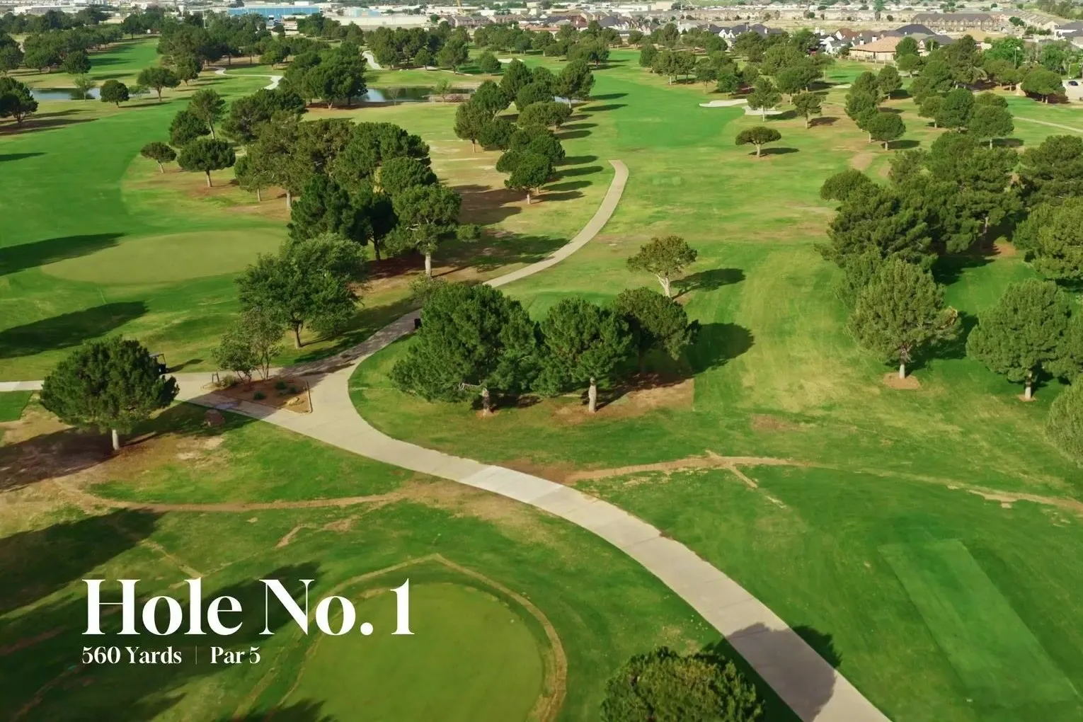
Odessa Country Club: Course Walkthrough
Plans get nodded at and then read three different ways. We flew the Old Course at Odessa Country Club hole by hole and cut a clean flythrough of each, so a committee, an architect, or a board can watch the same ground and talk about the course as it actually plays.
Read →
Land & Water
05
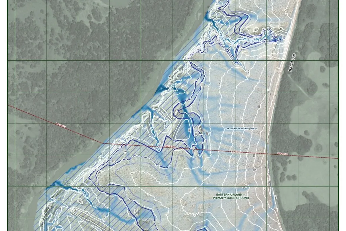
Grimes County Ranch · June 2026
Grimes County Ranch
A multi-tract Grimes County ranch where the buildable ground wasn't obvious at a glance. We flew it, modeled the terrain at one-foot contours, and ran the drainage and flood until the high, dry upland separated cleanly from the bottomland that floods.
Read →

06
Roy Kizer Golf Course · February 2026
Roy Kizer Golf Course: Pond Sealing Plan
A municipal complex was bleeding water through leaking pond beds. With the ponds drawn down, we flew them, mapped the exposed bed and the application boundary, cut each pond into numbered grid sectors, and put the bentonite in truckloads, so the crew knew where to seal and how much it would take.
Read →
Get in touch: jacob@caudelltg.com