Terrain intelligence for land and water.
Where to build, what floods, and how the ground moves.
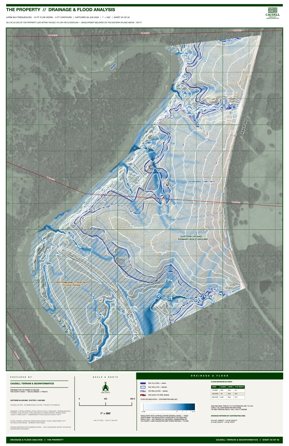
CTG maps the ground in high fidelity and turns it into plan sets and exhibits that hold up when a land deal or a development decision is on the line.
The work is the data and exhibit layer, not the certifier: it tells you where to build and what to keep clear of, before and alongside the engineer and surveyor who handle the stamping and permitting.
Topography and slope. Drainage and flood. Siting.
How it works
- 01
Scope
A call to size up the property and the questions it raises.
- 02
Capture
Drone LiDAR and photogrammetry, flown and processed in-house.
- 03
Deliver
Plan-scale exhibits that hold up when the decision is on the line.
Get in touch: jacob@caudelltg.com
Recent work: view a project sample